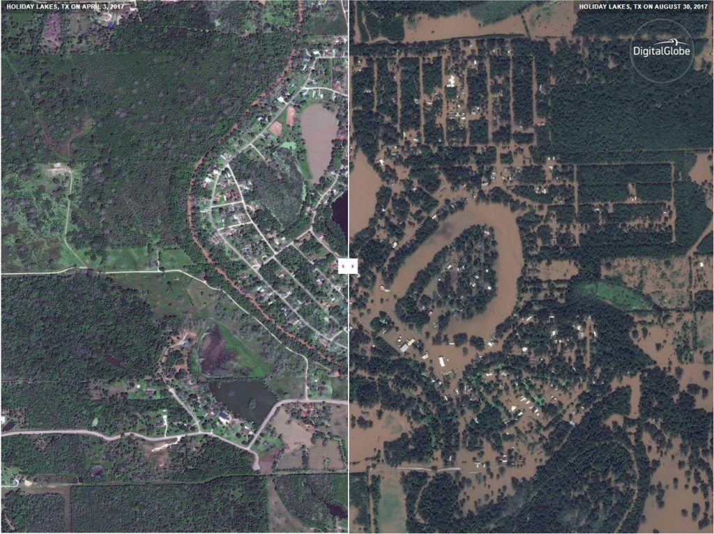
Check out the collection of side-by-side comparison of DigitalGlobe satellite images showing Houston before hurricane Harvey and after the flooding: Interactive before and after satellite photos show Harvey’s extreme flooding from orbit – Mashable
The company Deimos Imaging also posted several photos on Tweeter of Houston taken by their satellites: Houston flooding captured by Deimos-1 and Deimos-2 – Deimos Imaging –
#DEIMOS1 astounding animation shows before (May24) & after (Aug.31) #Harvey‘s devastating impact in Greater #Houston area #EmergencyResponse pic.twitter.com/lUttgncKxN
— DEIMOS IMAGING (@deimosimaging) September 1, 2017