New Horizons: High-resolution enhanced color view of Pluto

Check out the latest high-resolution image of Pluto made by the New Horizons probe during its fly-by in August: The Rich Color Variations of Pluto = NASA

crop_p_color2_enhanced_release_small[1]

NASA’s New Horizons spacecraft captured this high-resolution enhanced color view of Pluto on July 14, 2015. The image combines blue, red and infrared images taken by the Ralph/Multispectral Visual Imaging Camera (MVIC). Pluto’s surface sports a remarkable range of subtle colors, enhanced in this view to a rainbow of pale blues, yellows, oranges, and deep reds. Many landforms have their own distinct colors, telling a complex geological and climatological story that scientists have only just begun to decode. The image resolves details and colors on scales as small as 0.8 miles (1.3 kilometers).  The viewer is encouraged to zoom in on the full resolution image on a larger screen to fully appreciate the complexity of Pluto’s surface features. Credit: NASA/JHUAPL/SwRI

For the full details, see the
 

Video: TMRO 8.28 – “An update on Commercial Space”

The latest TMRO.tv show is now online: An update on Commercial Space – 8.28 – YouTube

This week we take a look at a few different commercial space companies and see where they are are. SpaceX, Orbital ATK and Virgin Galactic return to flight and Bigelow modules.

Space news items include:

* Debut of Long March 6 Rocket
* Debut of Long March 11 Rocket
* Rokot Launch
* Orbital ATK to supply boosters for Vulcan Rocket
* Super Moon Eclipse
* Upgraded Falcon 9 static fire test

Support TMRO:

TMRO Live is a crowd funded show. If you like this episode consider contributing to help us to continue to improve. Head over to http://www.patreon.com/tmro for information, goals and reward levels. Don’t forget to check out our Space Pod campaign as well over at http://www.patreon.com/spacepod

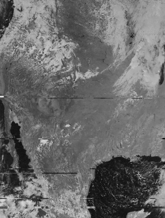
Low cost DIY ground station for weather satellite image reception

The HobbySpace Space Radio section has lots of information and web resources about home reception of satellite signals, especially for obtaining images from low earth orbit weather satellites. The price for such DIY systems was modest and now has gotten even cheaper.

Previously, one needed a wide-band radio tuner, which might cost a couple of hundred dollars, a simple antenna, a PC with a sound card, and some free software for turning the satellite data into images. Now with the arrival of Software Defined Radio programs, one can obtain a cheap “dongle”, i.e. a small device with a built-in tuner that plugs into a PC’s USB port for interfacing satellites signals to the PC.

Jason Davis of the Planetary Society gives a nice tutorial on building a system with about $50 in components (not counting a PC) that can be used for receiving weather sat images as well as data from a future LightSail mission: How to Download Weather Satellite Images from Space – The Planetary Society.

For additional info, Davis points to Receiving Weather Satellite Images for £8 – Matt Gray.

See also the RTL-SDR, a  very cheap software defined radio that uses a DVB-T TV tuner dongle”.

20150918_earth-noaa19_f537[1]A sample image from Jason Davis showing much of N. America
as received by his home ground station from the NOAA 19 satellite. 

Video: ‘Space to Ground’ report on the ISS – Sept.25.15

Here’s this week’s Space to Ground report on activities related to the Int. Space Station:

Everyone can participate in space