SkyTruth uses satellite imagery and measurements to monitor the globe for nefarious activities:
SkyTruth is a nonprofit organization using remote sensing and digital mapping to create stunning images that expose the landscape disruption and habitat degradation caused by mining, oil and gas drilling, deforestation, fishing and other human activities.
Our vision is a world where all people can see and understand the environmental consequences of human activity everywhere on Earth, and are motivated to take action to protect it.
Our mission is to motivate and empower new constituencies for environmental protection through illuminating the issues that impact our planet.
We use scientifically credible satellite images and other visual technologies to create compelling pictures that vividly illustrate environmental impacts, and provide these pictures and supporting data to environmental advocates, policy-makers, the media, and the public.
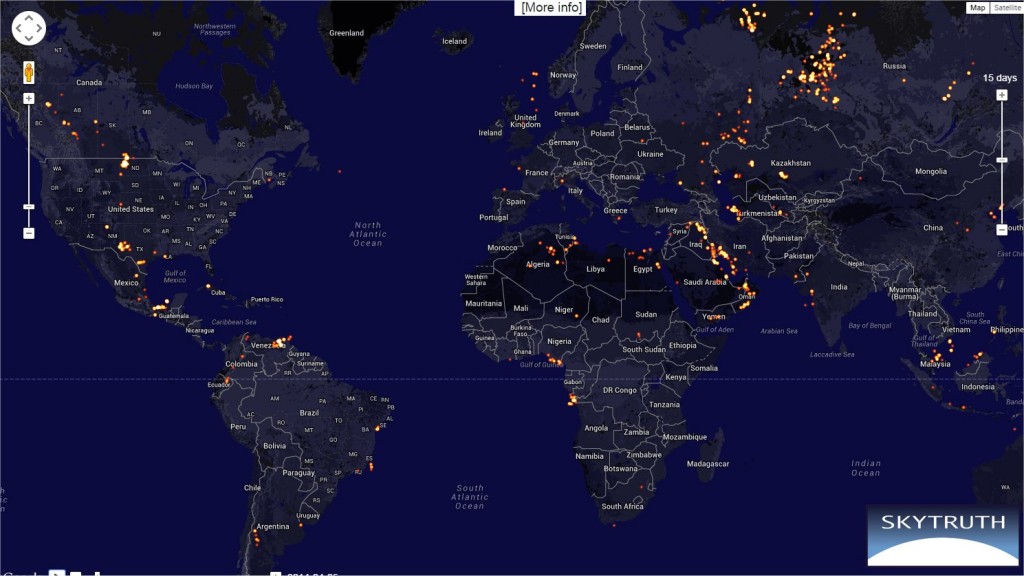
Here, for example, is a graphical display of gas flares around the world: Global Flaring Visualization – SkyTruth
A new program is the Global Fishing Watch:
Global Fishing Watch is the product of a technology partnership between SkyTruth, Oceana, and Google that is designed to show all of the trackable fishing activity in the ocean. This interactive web tool – currently in prototype stage – is being built to enable anyone to visualize the global fishing fleet in space and time. Global Fishing Watch will reveal the intensity of fishing effort around the world, one of the stressors contributing to the precipitous decline of our fisheries.
A visualization of ocean fishing activities was unveiled last fall Global Fishing Watch – SkyTruth. They are taking advantage of satellite tracking of ships via the Automatic Identification System (AIS). The AIS is based on a standardized transmitter on ships intended to help with maritime traffic control. Though the AIS signal is fairly short range and intended originally only terrestrial reception in coastal areas, it was shown a few years ago that it can be picked up by satellites in low earth orbit. Subsequently, several satellite systems now use AIS to provide maritime traffic monitoring. Here are two ship tracking visualization tools available on line for free:
- VesselFinder : Free AIS Ship Tracking of Marine Traffic
- Live Ships Map – AIS – Vessel Traffic and Positions – AIS Marine Traffic
This video lays out the Global Fishing Watch plan: