Earth images from the ISS combined with the music of Paul Simon’s “The Sounds of Silence” as performed by Disturbed: The Sound (& Visions) of Silence
====
Earth images from the ISS combined with the music of Paul Simon’s “The Sounds of Silence” as performed by Disturbed: The Sound (& Visions) of Silence
====
This video is about Hurricane Maria’s impact on Puerto Rico and the efforts by ISS crew member and Puerto Rican native Joe Acaba to boost the morale of youth on the island:
When Hurricane Maria devastated Puerto Rico in the fall of 2017, it had a profound effect upon the youth of the island. High above on the International Space Station, the astronauts living and working took notice. Joe Acaba, NASA’s first astronaut of Puerto Rican descent, heard the heartbreaking stories of the island’s youth and did all he could to connect. What transpired provided hope to thousands in a way that only the International Space Station could deliver.
A view of Hurricane Florence from the ISS as the storm made landfall off the East Coast of the US in September:
Cameras outside the International Space Station captured views of Hurricane Florence on Sept. 14 at 7:41 a.m. EDT minutes after the storm made landfall near Wrightsville Beach, North Carolina packing winds of 90 miles an hour. The National Hurricane Center said Florence is moving very slowly to the west at only 6 miles an hour, then is expected to turn to the southwest, increasing the threat for historic storm surge and catastrophic flooding to coastline areas and inland cities in North Carolina and South Carolina.
====
Satellites images reveal the huge extent of the damage from the earthquake and tsunami that hit Indonesia on September 28th: Satellite images of Indonesia earthquake and tsunami shows massive destruction – GeoSpatialWorld
The DigitalGlobe satellite images provided to CNN let one compare before and after views with a slide viewer: Before, after images show villages wiped away in deadly Indonesian earthquake, tsunami – CNN.
More images at:
====
This weekend, three earth observation spacecraft were sent into orbit by two different rockets. On Saturday morning the final launch of a Delta II rocket sent the Ice, Cloud and land Elevation Satellite or ICESat-2 into a polar orbit, the spacecraft will
use lasers and a very precise detection instrument to measure the elevation of Earth’s surface. By timing how long it takes laser beams to travel from the satellite to Earth and back, scientists can calculate the height of glaciers, sea ice, forests, lakes and more – including the changing ice sheets of Greenland and Antarctica.
Delta II rockets have been launched 155 times since the first flight on Feb. 14, 1989.
Here are two photos made by Anthony Galván III of the launch from Vandenberg AFB:
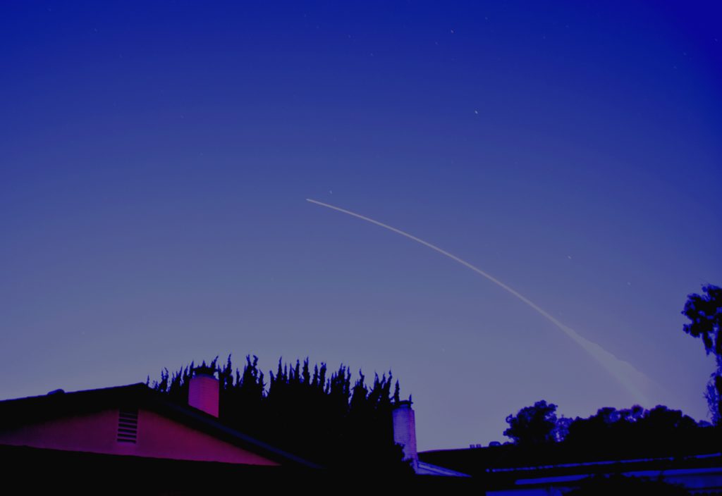
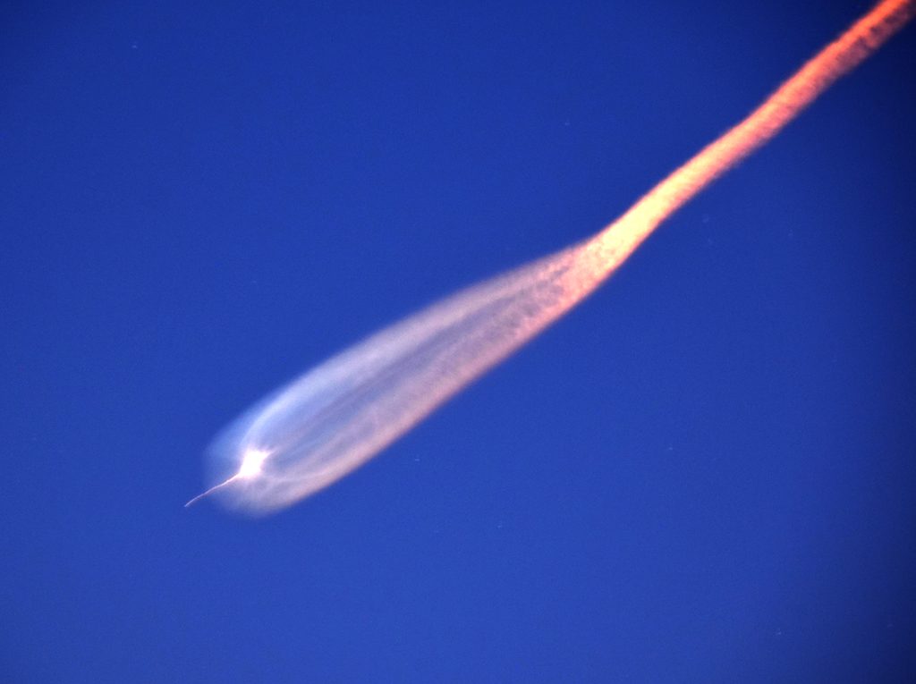
Anthony says,
The early morning launch was visible as the rocket’s exhaust plume was illuminated by the morning sun. However, downrange stage separation provided a spectacular view of the exhaust plume as the rocket climbs out of the earth’s shadow into direct sunlight.
===
Today the radar imaging satellite NovaSAR-1 and the high resolution optical imaging satellite SSTL S1-4 were sent into polar orbits by an Indian PSLV rocket:
Both satellites were built by Surrey Satellite Technology Ltd (SSTL), a spinoff from the smallsat program at the University of Surrey. (Airbus bought SSTL a few years ago but has kept it as an independent subsidiary.) SSTL confirms successful launch of NovaSAR-1 and SSTL S1-4 satellites | SSTL
NovaSAR-1 is the first SAR [Synthetic Aperture Radar] spacecraft to be manufactured entirely in the UK and is a technology demonstration mission designed to test the capabilities of a new low cost S-Band SAR platform. NovaSAR-1 will be the world’s first commercial SAR satellite to be operated at a 10:30 equator crossing time, providing time diversity for radar observations by affording increased daylight imaging opportunities in addition to night acquisitions. Synthetic Aperture Radar is a powerful tool for monitoring the Earth from space due to its ability to see through clouds and image the Earth night and day, and a constellation of three NovaSAR satellites could image any point on the globe every day, regardless of local time or weather.
…
SSTL S1-4 satellite is a sub one metre Earth observation satellite identical in design to the three DMC3/TripleSat Constellation satellites launched in 2015. A contract to provide data from SSTL S1-4 was signed with Twenty First Century Aerospace Technology Co., Ltd (21AT) in February 2018. As manufacturer and owner of the satellite, SSTL will lease imaging capacity to 21AT for the lifetime of the satellite, designed to be in excess of 7 years. SSTL S1-4 will contribute sub one metre resolution image data into 21AT’s existing TripleSat Constellation service, comprising three SSTL DMC3 satellites launched in 2015. SSTL S1-4 is capable of acquiring multiple targets in one pass, utilising spot, strip and mosaic imaging modes and 45 degree off-pointing agility for a range of applications including urban planning, agricultural monitoring, land classification, natural resource management and disaster monitoring. The very high resolution imager on board the spacecraft has been designed and manufactured by SSTL and will acquire sub one metre resolution images in panchromatic mode and sub four metre resolution images in multispectral mode, with a swath width of about 24km.
More about the launch and the two satellites:
====
Here’s the latest Space to Ground report from NASA on activities related to the International Space Station:
Hurricane Florence is heading towards the East Coast of the US. Good thing we have spacecraft like the ISS and weather satellites to provide lots of warning time on such storms: Hurricane Florence Viewed from the Space Station | NASA

A video from a week ago of the tropical storm Gordon:
====