Category Archives: Eyes in the Sky

Google Timelapse displays changes to any spot on earth over 32 years

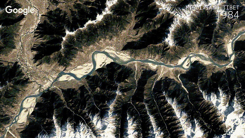
A few years ago, Google released the Timelapse Earth Engine that used historical remote sensing imagery as seen with Google Earth to show how parts of the earth had changed over time. Google has now released an updated version of the Engine. They have processed quadrillions of image pixels and used advanced image analysis techniques to expand and improve the Timelapse Earth Engine such that you can display a sequences of sharp looking images for most any spot on earth for each year over a span of more than three decades.

tibet_china1

Here is a reduced sized version of the Engine:

The full size version allows you to enter a location and the engine will zoom in on that place. Fun to see how one’s local area has changed over 30 years.

Sally Ride EarthKAM lets middle-school kids take photos of the world from the ISS

The Sally Ride EarthKAM program

is a NASA educational outreach program that enables students, teachers, and the public to learn about Earth from the unique perspective of space.

[It allows] middle school students around the world request images of specific locations on Earth.

Check out the gallery of EarthKAM images taken from the International Space Station.

The 55th round of EarthKAM imaging starts today:

earthcam_mission 54

Yesterday the crew on the ISS set up the EarthKAM for taking images: ISS Daily Summary Report – 11/07/2016 | ISS On-Orbit Status Report:

Sally Ride Earth Knowledge Acquired by Middle Schools (EarthKAM):
The crew configured the camera, laptop and associated Sally Ride EarthKAM software at the Node 2 Nadir hatch window. Once configured, the EarthKAM team, in association with middle school students around the world, selected image targets which will be downlinked and used in the study of physics, computers, geography, math, earth science, biology, art, history, and cultural studies.

The objective of Sally Ride EarthKAM is to integrate Earth images with inquiry-based learning to enhance curricula in support of national and state education standards; to provide students and educators the opportunity to participate in a space mission and to develop teamwork, communication, and problem solving skills; to engage teams of students, educators, and researchers in collaborative investigations using remotely-sensed data; and to incorporate the active use of Web-based tools and resources in support of the learning process.

In this video, Tom Marshburn shows how the EarthKAM is set up on the ISS:

Leesa Hubbard is a school teacher in Tennesseee and here she talks about using the EarthKAM and other space resources in her science lessons:

Videos: “Space to Ground” ISS report + ISS view of hurricane Nicole

Here is this week’s episode of NASA’s Space to Ground report on activities related to the Int. Space Station:

And here is a video showing views of hurricane Nicole as seen from the ISS on Thursday:

Here is a report from Kennedy Space Center with a description of  the effects of hurricane Matthew:

Videos: “Space to Ground” ISS report + New views of Matthew from the ISS

Here is the latest Space to Ground report on ISS related activities for the week:

And here are a couple of the latest NASA videos of hurricane Matthew:

Cameras outside the International Space Station captured new views Oct. 6 of massive Hurricane Matthew at 4:45 p.m. EDT as the outpost flew 250 miles overhead. At the time of the flyover, Matthew was moving to the northwest through the Bahamas, strengthening to a possible Category 4 hurricane that is expected strike the east coast of Florida and track up the Space Coast Oct. 7 with winds that could reach 145 miles an hour, according to the National Hurricane Center.

Cameras outside the station captured new views today of massive Hurricane Matthew as it flew 250 miles overhead at 4:45pm ET. At the time of the flyover, Matthew was moving to the northwest through the Bahamas as a Category 4 hurricane that is expected to strike the east coast of Florida and track up the Space Coast Oct. 7 with winds that are expected to reach a destructive 145 miles an hour, according to the National Hurricane Center.

Follow Hurricane Matthew from space on line

NASA is providing updates, images, and videos as the storm aims for the coast of Florida:

===

There could be severe flooding of the Kennedy Space Center and the Cape Canaveral Air Station: Kennedy Space Center Updates

===

Find satellite and other views of the storm at NOAA’s

===

Here is a video taken on Wednesday from the International Space Station showing the hurricane:

===

It may go out of action eventually, but here is a webcam showing the waves of Cocoa Beach: Cocoa Beach Surf Report and Cocoa Beach Pier Surfcam – Florida Surf Cams